Back لامار (ميزوري) Arabic لامار (بارتون) ARZ لامار، میزوری AZB Lamar (Missouri) Catalan Ламар (Миссури) CE Lamar (kapital sa kondado sa Tinipong Bansa, Missouri) CEB Lamar, Missouri Welsh Lamar DAG Lamar (Missouri) German Lamar (Misuri) Spanish
Lamar, Missouri | |
|---|---|
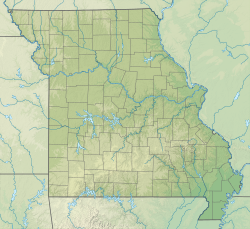
 Location of Lamar, Missouri | |
| Coordinates: 37°29′52″N 94°16′45″W / 37.49778°N 94.27917°W | |
| Country | United States |
| State | Missouri |
| County | Barton |
| Area | |
| • Total | 5.53 sq mi (14.32 km2) |
| • Land | 5.21 sq mi (13.51 km2) |
| • Water | 0.31 sq mi (0.81 km2) |
| Elevation | 951 ft (290 m) |
| Population (2020) | |
| • Total | 4,266 |
| • Density | 818.18/sq mi (315.88/km2) |
| Time zone | UTC-6 (Central (CST)) |
| • Summer (DST) | UTC-5 (CDT) |
| ZIP code | 64759 |
| Area code | 417 |
| FIPS code | 29-40376[3] |
| GNIS feature ID | 2395617[2] |
| Website | cityoflamar.org |
Lamar is a city in and the county seat of Barton County, Missouri, United States.[4] As of the 2020 census, the city population was 4,266.[5] It is known as the birthplace of Harry S. Truman, the 33rd president of the United States.
The city government is consolidated with City Township.[6] Because the city governance and township governance have different roles. circa 2002 the U.S. Census Bureau counted them as separate governments for census purposes.[7] The city of Lamar is surrounded by, but is not part of, Lamar Township.
- ^ "ArcGIS REST Services Directory". United States Census Bureau. Retrieved August 28, 2022.
- ^ a b U.S. Geological Survey Geographic Names Information System: Lamar, Missouri
- ^ "U.S. Census website". United States Census Bureau. Retrieved January 31, 2008.
- ^ "Find a County". National Association of Counties. Retrieved June 7, 2011.
- ^ "Explore Census Data". data.census.gov. Retrieved January 12, 2022.
- ^ U.S. Census Bureau. "Guide to State and Local Census Geography" (PDF). Archived from the original (PDF) on December 10, 2016. (updated for 2010 Census)
- ^ "Missouri" (PDF). U.S. Census Bureau. p. 1. Retrieved November 1, 2024.

